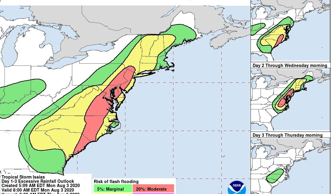
Tropical Storm Isaias continues to move up along the Florida east coast Monday and is expected to impact the community later tonight into Tuesday morning.
As of 3 p.m. on Monday, Aaron Swigget from Raleigh’s National Weather Service said most of the tropical storm warnings are occurring to the east, starting in Wake County.
Swigget said the Triangle can still expect to see some effects from the storm.
“We can see some pretty good wind gusts, mostly in the 20 and 30 miles per hour range, and as for rainfall we’re looking at one to three inches in and around our area,” Swigget said.
He said the Chapelboro viewing area will most likely see its biggest impact starting tonight, sometime between 8 p.m. and 2 a.m. Tuesday morning.
“It’s a relatively fast moving storm so it will be in and out of our area fairly quickly which will limit the impact slightly – especially in regards to a flooding event,” Swigget said.
The National Hurricane Center (NHC) predicts Tropical Storm Isaias will be reclassified as a hurricane by Monday night with dangerous winds and storm surge.
Per the National Hurricane Center’s 8 a.m. update on Monday, the storm maintained its 70 mph winds overnight — keeping it just under a hurricane – and is expected to head north over the Carolinas by early Tuesday.
According to the NHC, heavy rainfall will result in flash and urban flooding – some of which will be significant in the Eastern Carolinas.
As the community prepares for increased rainfall and winds, the Town of Carrboro said they are doing what they can to prepare for the storm.
The Town of Chapel Hill urged its residents to stay up to date on current storm conditions by following the National Weather Service and local media outlets.
OWASA provided their own information via Twitter, stating that tap water is still safe to drink in the event of power outages.
Additionally, OWASA provided a link to their web page listing active boil water advisories and planned outages.
This is a developing story. No further information at this time.
Lead photo via the National Hurricane Center.
Chapelboro.com does not charge subscription fees. You can support local journalism and our mission to serve the community. Contribute today – every single dollar matters.
Related Stories
‹
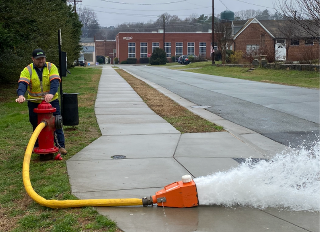
OWASA to Temporarily Change Water Disinfection Process, Release Water from Fire HydrantsOrange Water and Sewer Authority will temporarily alter its drinking water treatment process throughout the month of March, using just chlorine instead of a combination of chlorine and ammonia. “Water will remain safe to drink during this time, but customers might notice a change in taste or odor of drinking water,” said a release from OWASA. OWASA […]
![]()
Chapel Hill, Carrboro Mayor Challenge Residents to Save WaterIt’s the upcoming showdown everyone is talking about! Chapel Hill and Carrboro will square off in a friendly competition to save water during the month of April. The mayors of Chapel Hill and Carrboro challenged each other on March 22, World Water Day. Chapel Hill Mayor Pam Hemminger said besides conserving fresh water, the Mayors […]
Public Meeting Scheduled Ahead of Underground Blasting for Rogers Road Sewer ProjectA public meeting is set for Tuesday after officials from Chapel Hill, Carrboro, Orange County and Orange Water and Sewer Authority have decided to move forward with “low-intensity underground blasting” to remove rock as part of the Rogers Road Area Sewer Project. After decades of promises to extend the sewer lines to the historically black […]
![]()
Consultant Reviewing OWASA Response to Water Main BreakOrange Water and Sewer Authority officials are working to find out what happened earlier this week to cause a major water main break. The issue occurred early Monday morning and disrupted water availability across southern Orange County through Tuesday afternoon. “With so much water being lost, it made it impossible to safely access the valves […]
![]()
OWASA Lifts Boil Water AdivsoryOWASA officials said just before 4:30 p.m. that the boil water advisory for the area had been lifted. There are 75 customers who have been directly contacted, according to the utility, who will have to continue under a boil water advisory, but the rest of the service area is working at a normal capacity.**** […]
![]()
Some Improvements at OWASA Water Main Break, But UNC to Remain Closed TuesdayOWASA officials said just after 7:30 p.m. Monday that the leak had been stopped and that water storage was approaching normal levels. Officials are continuing to urge residents to use water wisely. Toilets can be flushed. Customers are asked to take short showers.**** Orange Water and Sewer Authority reported seeing some improvements Monday evening […]
![]()
Hillsborough Supplying Water to Customers Impacted by OWASA OutageHillsborough has begun supplying water to the southern portion of the county serviced by Orange Water and Sewer Authority. OWASA suffered a significant water main break early Monday morning. The utility then asked customers to limit water use to essential purposes and then issued a boil water advisory. Chapel Hill – Carrboro City Schools and […]
![]()
Orange County Preparing for Election Day Amid OWASA ComplicationsOrange County elections officials say the county will be ready to go for Election Day regardless of issues caused by a water main break at the Orange Water and Sewer Authority facility in Carrboro. The water main break has caused closures across southern Orange County, including Chapel Hill – Carrboro City Schools and UNC – […]

Water Main Break Forces Closures Across Chapel Hill, CarrboroChapel Hill – Carrboro City Schools are closing early Monday due to complications from a water main break in Carrboro. The break also caused UNC – Chapel Hill to move to Condition 2 at 11:30 a.m. Monday. Classes are canceled and all non-mandatory operations are suspended through 11 p.m. Monday. Orange Water and Sewer Authority has […]
![]()
OWASA: Tap Water Safe if Hurricane Florence Causes Power OutageResidents across central North Carolina have been searching for bottled water and other provisions ahead of the expected arrival of Hurricane Florence later this week. Orange Water and Sewer Authority said on Tuesday evening that tap water will remain safe to drink, even if the power is knocked out during the storm. OWASA is the […]
›
