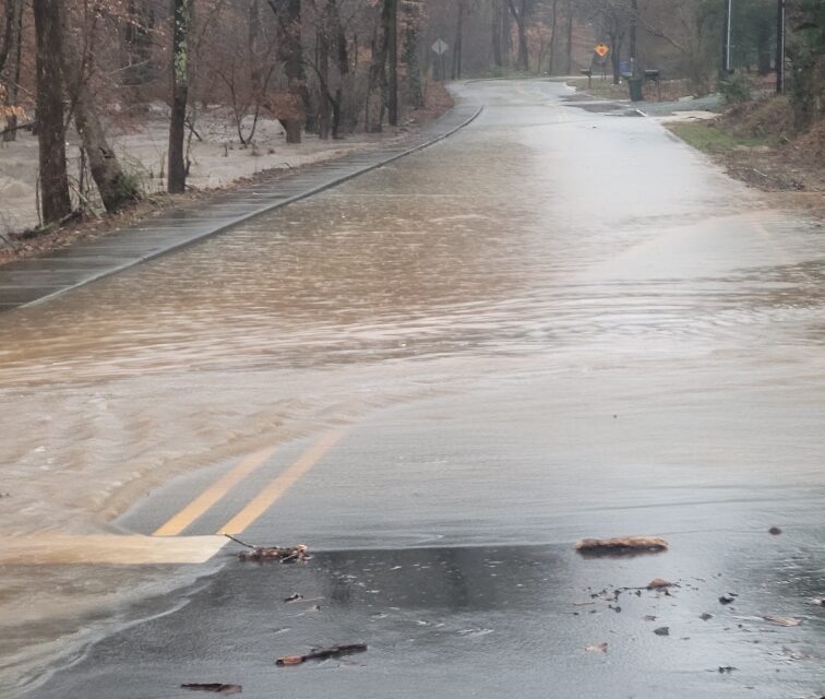
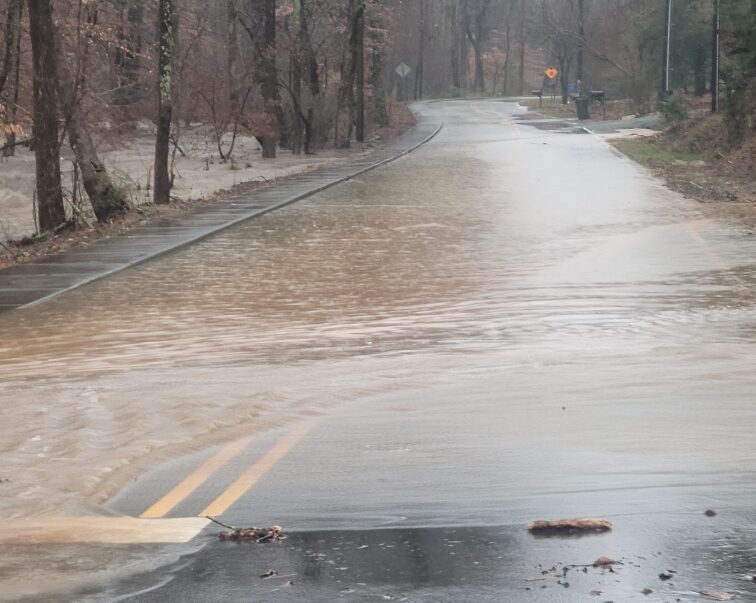
Orange and Chatham counties suffered flooded roads from rainfall and downed power lines from high winds during a powerful storm system on Tuesday.
Shortly after the National Weather Service issued its first flash flood warning from the storm, the Town of Chapel Hill reported flooding along Umstead Drive — with water washing over the road between Pritchard Avenue Extension and Greene Street. Later on Tuesday, the town warned travelers to avoid South Estes Drive between Franklin Street and Fordham Boulevard due to lanes were closed due to high water. All roads impacted by flooding normal traffic patterns at 9:30 p.m. on Tuesday, according to the town.
Other creeks and low-lying areas in Chapel Hill also so much flooding, with Chapelboro readers sharing photos of flooding around Bolin Creek in Chapel Hill and Carrboro. The Orange Water and Sewer Authority said it responded to a report of water overflowing from a manhole cover to the sewers. The local agency said around 1,500 gallons overflowed from the spot, with the water receding within 30 minutes of the report. OWASA said on Wednesday state officials were notified of the overflow, but no further action was required by its response crews on Tuesday night.
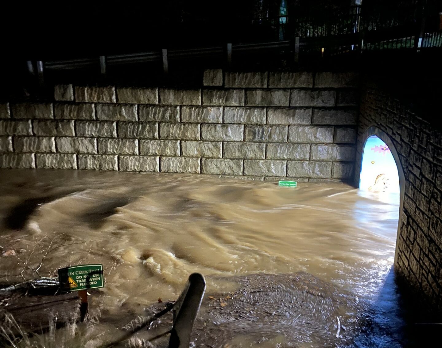
The foot traffic tunnel under Pritchard Avenue Extension in Chapel Hill saw the nearby Bolin Creek Flood it on Tuesday night during the storm. (Photo via Laura Sligar.)
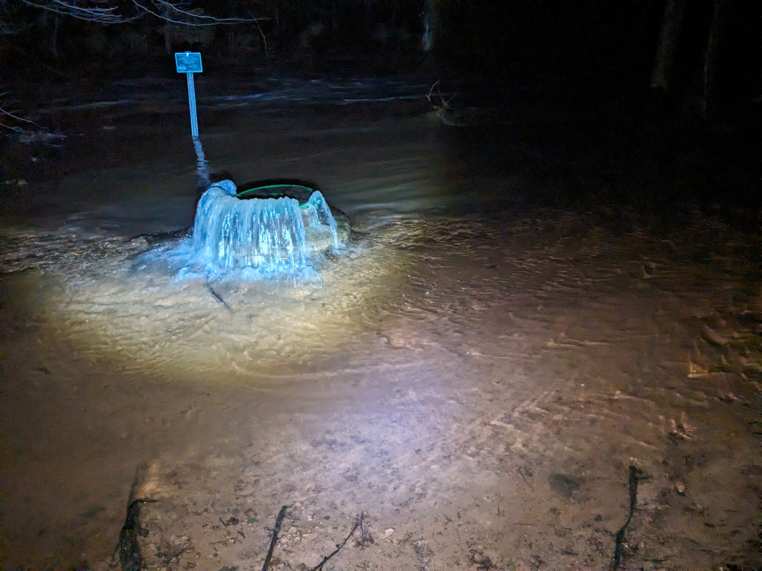
A sewer pipe in Carrboro near Bolin Creek overflows and floods with storm water on January 9, 2024. (Photo via Anthony Altemara.)
In Carrboro, Jones Ferry Road also experienced flooding late Tuesday afternoon — causing Chapel Hill Transit to detour some of its routes that use the road.
The Town of Hillsborough also warned residents about active flash flooding, saying the Churton Street and Orange Grove Road intersection was closed due to severe floodwaters. Other streets also saw high waters, including Baycourt Trail, Nash Street and Wake Street.
Hillsborough’s cleanup from the storm continued on Wednesday, with the town saying the Riverwalk and Gold Park are closed to all travelers as crews clean up water, silt, and debris.
Power Outages
According to Duke Energy’s Outage Map, several communities within Orange, Chatham and Durham counties experienced a loss of power during Tuesday’s storm.
As of 7:15 p.m. on Tuesday, Duke Energy reported 50 active outages in Orange County, meaning close to 4,000 Orange County customers had no power. That included several people in Hillsborough and Efland. Meanwhile, northeast Chapel Hill, Carrboro and much of downtown Durham also reported hundreds of customers experiencing outages.
Much of downtown Hillsborough, as well as neighborhoods stretching north into rural Orange County, reported outages caused by wind and downed trees. (Photo via Duke Energy, as of 7:15 p.m.)
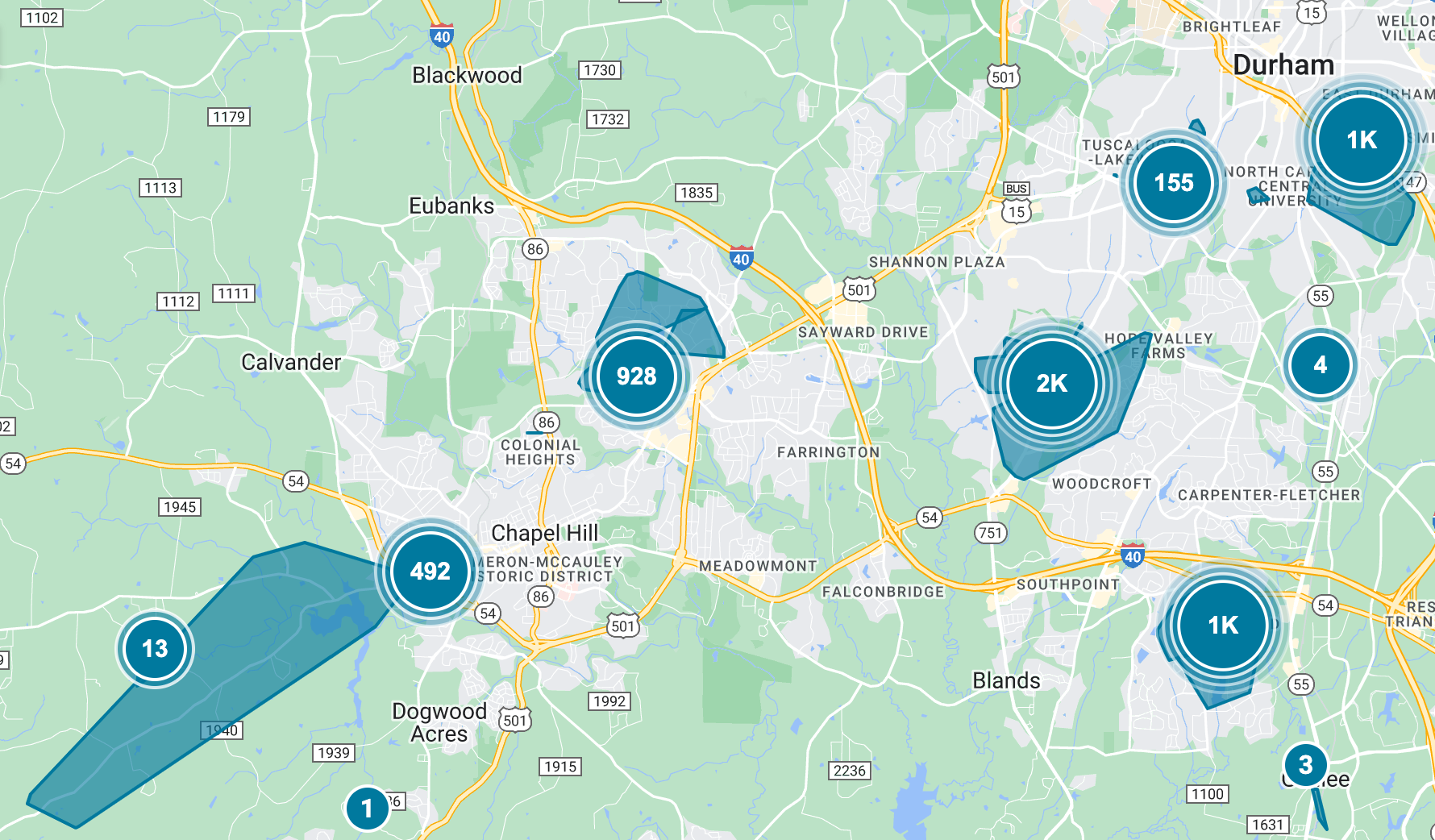
Neighborhoods of Chapel Hill, Carrboro and Durham also experienced a loss of power Tuesday night. (Photo via Duke Energy, as of 7:15 p.m.)
Much of Chatham County’s power outages stemmed from more than 600 customers without power around Siler City.
School Delays
As a result of the power outages and debris from the storm, two school districts announced delays for students and families for Wednesday morning.
Orange County Schools cited “the potential for hazardous travel in the morning” for its decision to have a two-hour delay for all students and staff. Chatham County Schools, meanwhile, said power outages and downed trees in the county were the main contributors to its own two-hour delay for the district.
Chapel Hill-Carrboro City Schools encouraged students and staff on Tuesday night to prepare for normal hours of instruction on Wednesday, noting many outages, flooding, and debris caused by the storm are expected to subside by the morning.
Tornado Watch
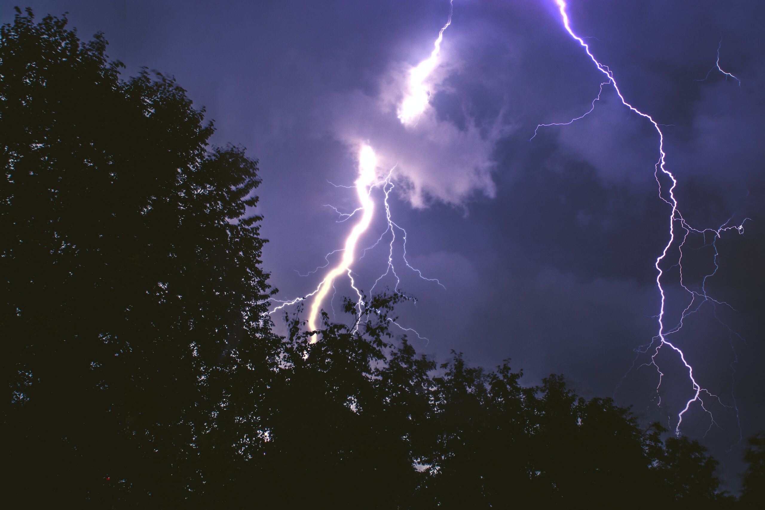
Orange, Chatham and Durham counties were also under a tornado watch on Tuesday, as was much of central North Carolina. The National Weaver Service issued the watch shortly before 2 p.m. on Tuesday, saying the region could be at risk for tornadoes, hail and significant wind. The agency forecasted scattered gusts of wind potentially up to 70 mph, escalating the strong winds expected across central North Carolina.
While northern Durham County and some areas north of Orange and Chatham saw tornado warnings, the National Weather Service did not confirm any tornado touchdown in the community.
The announcement came after the National Weather Service included Orange, Chatham and Durham counties in its wind advisory set in place for Tuesday. The region also experienced a severe thunderstorm warning, which lasted for approximately two hours and expired at 6:15 p.m.
As preparation for the possibility of tornadoes, power outages, or any other results of severe weather, the National Weather Service recommended people check emergency supplies and discuss any emergency plans with those nearby. If a tornado warning occurs, people are urged to move to a low floor in a sturdy building, stay in an interior room, and to avoid windows.
More information on the differences between tornado watches and tornado warnings, as well as safety tips, can be found on the National Weather Service website.
Emergency Alerts
The Orange County Alerts system, as well as Alert Carolina for the UNC community, sent out their own respective messages to residents to make people aware of the tornado watch. In its message to the campus community, UNC said it would move its operations to Condition 1 starting at 4 p.m. Tuesday through the rest of the day — meaning people should “consider their own personal circumstances” to determine whether to proceed like normal.
Gov. Roy Cooper issued a state of emergency for North Carolina on Monday evening, urging people to be prepared on Tuesday for any flooding or power outages.
Photo via the Town of Chapel Hill.
Chapelboro.com does not charge subscription fees, and you can directly support our efforts in local journalism here. Want more of what you see on Chapelboro? Let us bring free local news and community information to you by signing up for our biweekly newsletter.


