****UPDATE: The tornado watch in the Orange County and Chatham County regions was called off by the National Weather Service shortly before 10 a.m. on Monday.****
https://twitter.com/NWSRaleigh/status/1249698753193230336?ref_src=twsrc%5Egoogle%7Ctwcamp%5Eserp%7Ctwgr%5Etweet
After experience rain and strong winds Sunday night, the Chatham and Orange County regions will continue to experience strong winds through Monday.
A tornado watch was issued for the region shortly after 5 a.m. and was in place until 12 p.m. Monday before being canceled. Orange County is also under a severe thunderstorm warning through the morning, which began before 6:30 a.m.
The strongest wave of storms arrived in the Triangle region after midnight Monday, with the heaviest storms continuing through sunrise. The National Weather Service of Raleigh tweeted on Sunday damaging winds, large hail and powerful long-track tornadoes will be possible.
The high winds in the region are expected to create power outages in the area. To keep track of any outages for Duke Energy customers, visit the Duke Energy Outage Map.
Orange County residents can sign up for emergency messages through OC Alerts here.
Photo via the National Weather Service.
Related Stories
‹
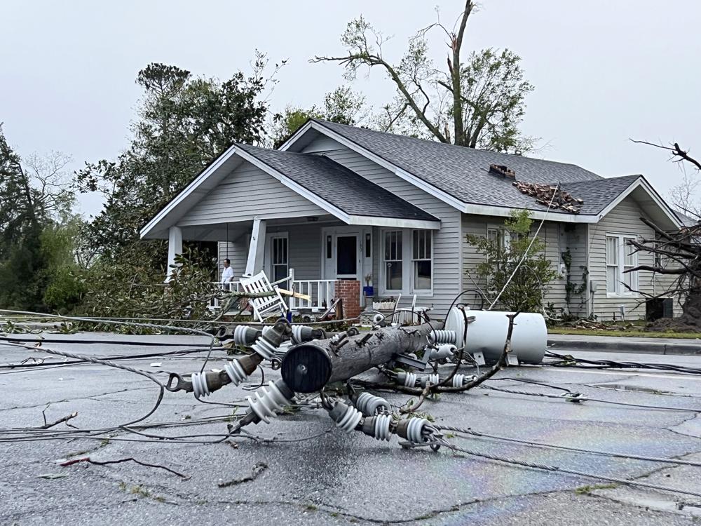
Residents Clear Trees, Assess Damage From Southern StormsWritten by THE ASSOCIATED PRESS Southerners were clearing trees from roads and buildings as weather forecasters planned to survey damage from several possible tornadoes in Georgia and South Carolina, but said that effort could be interrupted by the potential for more storms Wednesday. Tuesday’s storms killed at least two people — one in Texas and […]

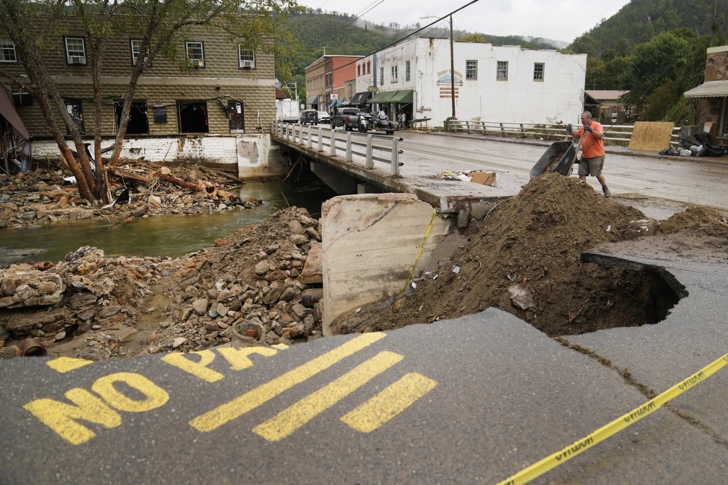
Easter Storms Sweep South, Killing at least 19 PeopleSevere weather has swept across the South, killing at least 19 people and damaging hundreds of homes from Louisiana into the Appalachian Mountains. Many people spent part of the night early Monday sheltering in basements, closets and bathroom tubs as sirens wailed to warn of possible tornadoes. Eleven people were killed in Mississippi, and six […]

Tornado Watch Issued as Orange, Chatham and Durham Counties Brace for Severe WeatherAs a band of strong storms sweeps across North Carolina on Monday, the Piedmont is bracing for high winds and the chance of tornadoes.

Despite Restored Water Operations, Town of Hillsborough Faces Extensive Costs From FloodingWhile the Town of Hillsborough ended its conservation call for water and sewer customers after flooding damaged and contaminated its treatment plants, the road back to normal operations appears to be long for the small town. Historic rain from Tropical Depression Chantal led to flooding levels not seen for decades in Orange County, with parts […]

'Everything Is A Complete Loss': Eastgate Crossing Businesses Assess Flood DamageAt Chapel Hill's Eastgate Crossing shopping center, Tropical Depression Chantal left not a single business unscathed.

Days After Historic Rain, Chapel Hill and Durham Under Another Flash Flood WarningMany areas of Orange County, Chatham County and the rest of central North Carolina are again under a flash flood warning on Wednesday.

Orange County Reports First Fatality From Storm; Shelter Opens for Flood VictimsAs the area continues assessing storm damage and waiting for high waters to recede, Orange County opened a public shelter at Smith Middle School.
Top Stories of 2024: Hurricane Helene and the Dizzying Cost of DisasterJoining the names of Hugo, Hazel, Florence and Fran, Helene represents another entry into North Carolina's shared history with hurricanes.

US Severe Weather: Heat Moves East, Storms Threaten Plains, Snow Falls in the RockiesHot and cold extremes are expected this week in the U.S., as residents are warned about a heat wave moving east.
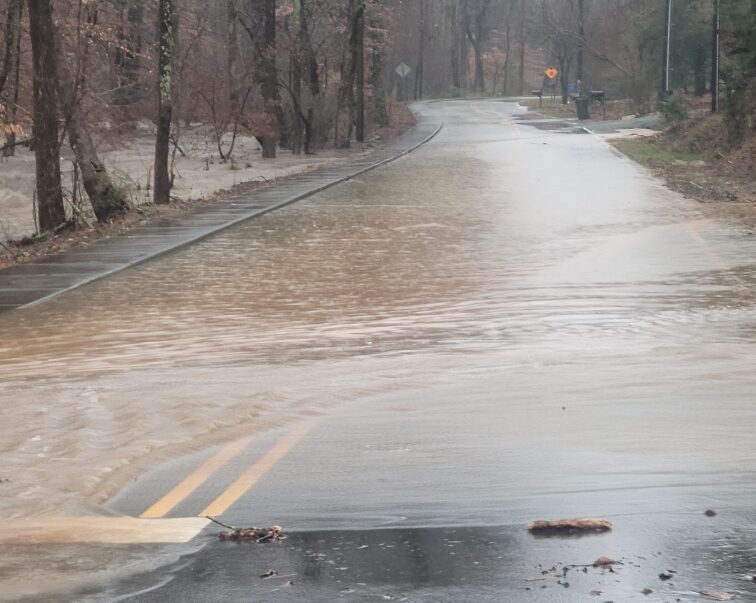
Flooding, Power Outages and School Delays; Here Are Storm Updates from Orange, Chatham CountiesOrange and Chatham counties suffered flooded roads from rainfall and downed power lines from high winds during a powerful storm system on Tuesday. Shortly after the National Weather Service issued its first flash flood warning from the storm, the Town of Chapel Hill reported flooding along Umstead Drive — with water washing over the road […]
›
