RALEIGH – National Weather Service Meteorologist-in-Charge, Darin Figurskey says morning commuters from Northern Orange County are the most likely to be affected by Monday night’s potential frozen precipitation.
“It should be mostly light,” Figurskey says. “The impact should be relatively minimal. But, people getting ready to plan the early morning commute Tuesday—especially going north and west—should, kind of, keep stock of the weather.”
He says the southern parts of Orange and Durham counties should be warm enough to not be affected, but bridges and overpasses are—as always—the areas to watch out for first.
“Look for maybe some very light icing—especially on those elevated surfaces, those typical cool spots: bridges, overpasses,” Figurskey says.
Just before sunrise, Figurskey says the temperatures will rise, and the threat of frozen precipitation won’t be around the remainder of the week.
“Morning time temperatures could be a degree or two above freezing depending on when the precipitation moves in, and then during the day Tuesday, temperatures will just continue to rise slowly,” Figurskey says.
For the latest forecast, click here.
Related Stories
‹
'It's a Pretty Impactful Storm': Snow Arriving in the Triangle SaturdayForecasters are calling for 4-8 inches of snow to hit the Triangle this weekend, just a week after the ice of Winter Storm Fern.
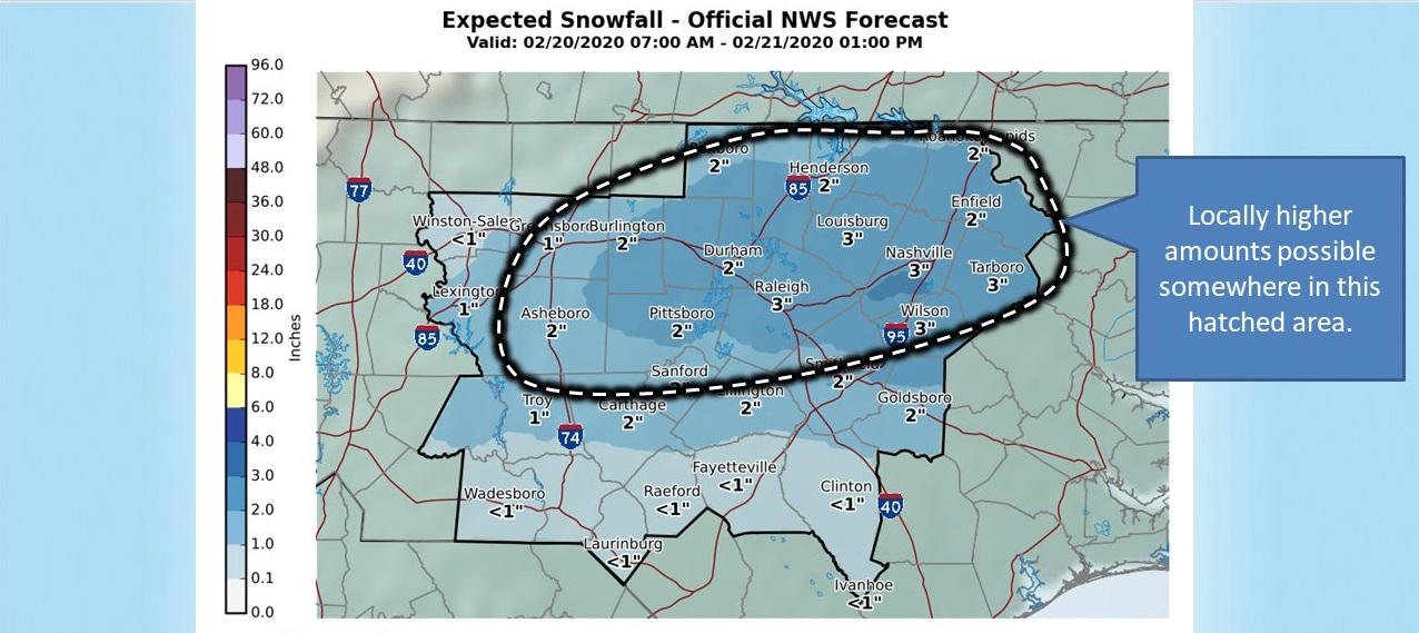
Winter Weather Advisory Issued for Orange County, Parts of ChathamThe National Winter Weather Service has issued a winter weather advisory for Orange County and Chatham County, as well as other counties in the region, for the upcoming days. Rainy weather is expected to turn to snow flurries over the course of Thursday, February 20, according to the department. By Thursday night, snow fall and […]
![]()
Winter Storm Warning Issued for Orange CountyThe National Weather Service has issued a winter storm warning for Orange and neighboring counties in response to projected snowfall across central North Carolina. The warning will remain in effect from Friday evening to Saturday evening, with three to five inches of snow accumulation possible in the Triangle area during that time. Kirby Saunders, the emergency management […]
![]()
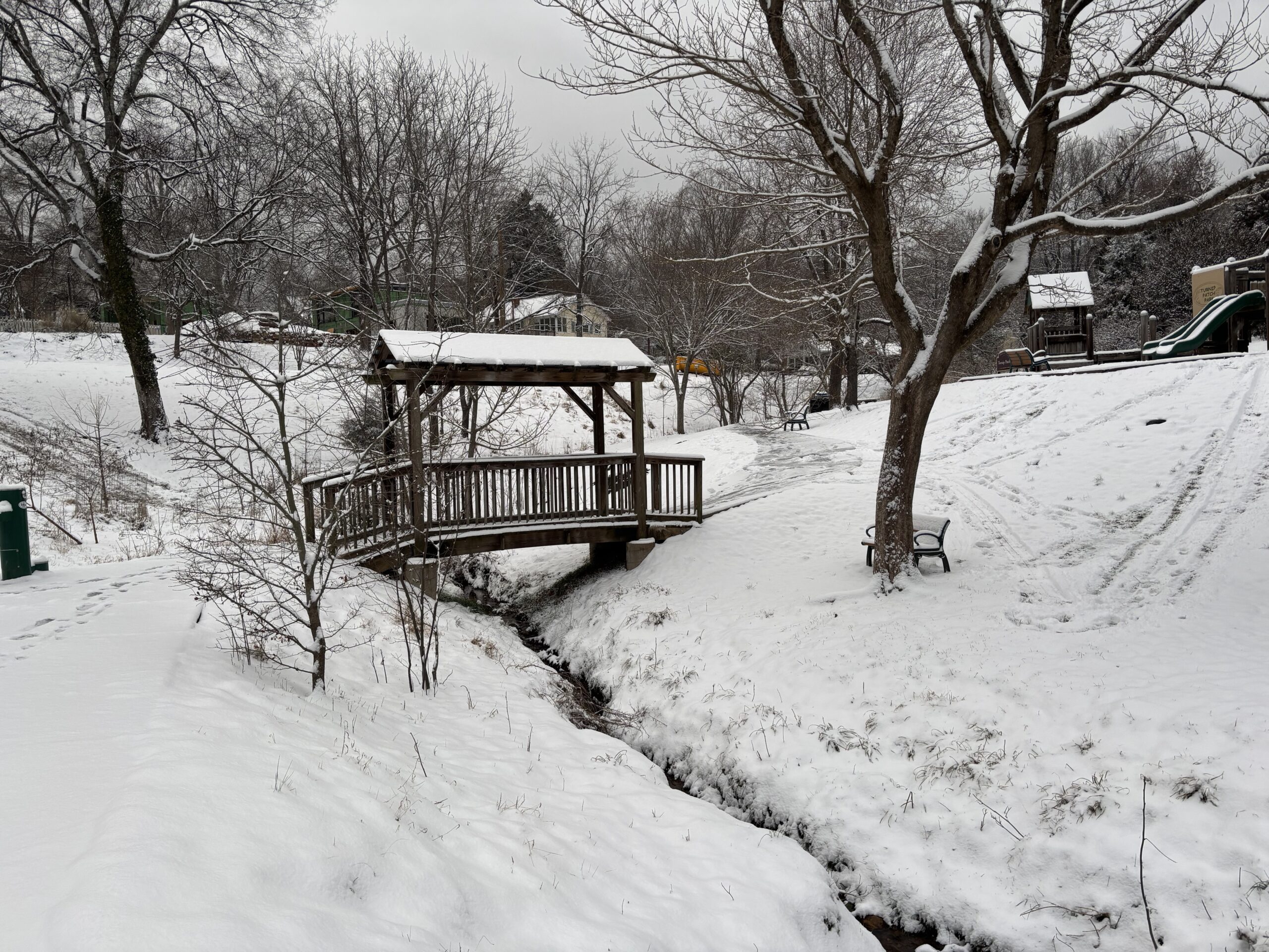
Snow and Ice in Chapel Hill and HillsboroughSnow and ice fell on Chapelboro area on Friday, January 22, 2016 and Saturday, January 23, 2016. Visit our closings and delays page and stay up-to-date on what’s happening with the weather. Follow us on Twitter for more. Share your photos with us: info@chapelboro.com.
![]()
When It Snows, Who Clears The Sidewalks?When it comes to clearing snow off sidewalks and private parking lots, turns out it's a question of "home rule."
![]()
In Hillsborough, Just Seven People To Clear The RoadsHillsborough Mayor Tom Stevens.
![]()
Clouds To Keep Temperatures Down Tuesday, Warmer WednesdayNational Weather Service meteorologist Ryan Ellis says temperatures will stay in the 30s Tuesday, but the Triangle will see-saw right back to the 50s by Wednesday.
![]()
Thin Glaze Of Ice Could Coat Trees Monday And TuesdayAnother dose of winter weather is on tap before spring officially arrives, but just how bad with this round be?
![]()
Cold Front To Bring Frozen PrecipitationNational Weather Service Senior Forecaster Scott Sharp says once the cold front moves through the Triangle between 7:00 and 7:30 Monday morning, we should expect rain to switch to sleet at about midday.
![]()
Thawing Temperatures On Their WayNational Weather Service meteorologist Kathleen Carroll says the forecast is clear of frozen precipitation--at least in the near future--and temperatures are projected to be in the 40s Friday.
›
