(Tropical Storm Andrea is expected to cause some delays to this weekend’s UNC-South Carolina series at Boshamer Stadium.)
CHAPEL HILL – The National Weather Service has issued a Flash Flood Watch for the entire Triangle until 6:00 p.m. Friday, as Tropical Storm Andrea is expected to drop more than two inches of rain on the area when it arrives late Friday morning.
That’s on top of about half an inch of rain that fell on Thursday, part of an entirely different system.
WCHL’s Aaron Keck spoke with National Weather Service meteorologist Shawna Coakley during the WCHL Thursday Evening News.
AARON KECK: What can we expect to see from Tropical Storm Andrea?
SHAWNA COAKLEY: We’ll see rainfall increasing beginning tonight and into tomorrow; we could see 2-3 inches of rain during the day tomorrow.
AK: When is the rain from Andrea likely to begin?
SC: We have a warm front just to the south of our area right now; Andrea will start affecting the area Friday morning, through the day Friday, and then it will rapidly accelerate off the coast Friday evening.
AK: When will we see the worst of the rain?
SC: We’re expecting the heaviest rainfall to be Friday morning and afternoon.
AK: Could there be anything worse than thunderstorms? Tornadoes?
SC: We don’t expect any widespread severe weather–because (of) the track of the system, tornadoes in this area won’t be a major concern.
AK: And again, this is heading up the east coast, so the worst of the weather will be off to the east of the Triangle by the Outer Banks, yes?
SC: That’s right.
AK: What can we expect in terms of wind?
SC: The wind shouldn’t be terribly strong, but we could see a few gusts into the 20-30 mph range.
AK: And when can we expect to see the whole system move out?
SC: We’ll see conditions start to improve Friday evening, and the system will be out of our hair during that period.
Related Stories
‹
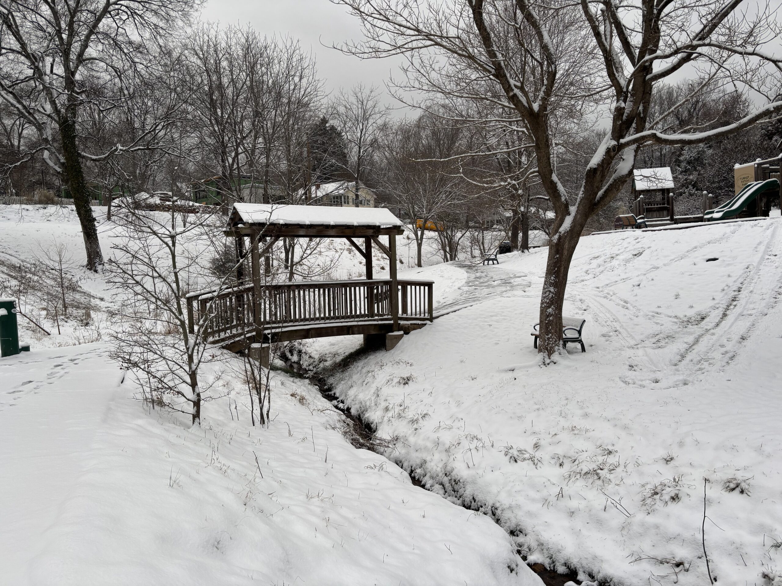
'It's a Pretty Impactful Storm': Snow Arriving in the Triangle SaturdayForecasters are calling for 4-8 inches of snow to hit the Triangle this weekend, just a week after the ice of Winter Storm Fern.

Orange, Durham Schools End Week Early Due to Severe Weather ForecastThe threat of severe thunderstorms, high winds and potentially hail has the school systems in Orange, Chatham and Durham counties changing plans on Friday. Durham Public Schools announced around 10:30 a.m. they would be ending classes two hours earlier than normal because of the weather forecast, with all after-school activities being canceled as well. Due […]
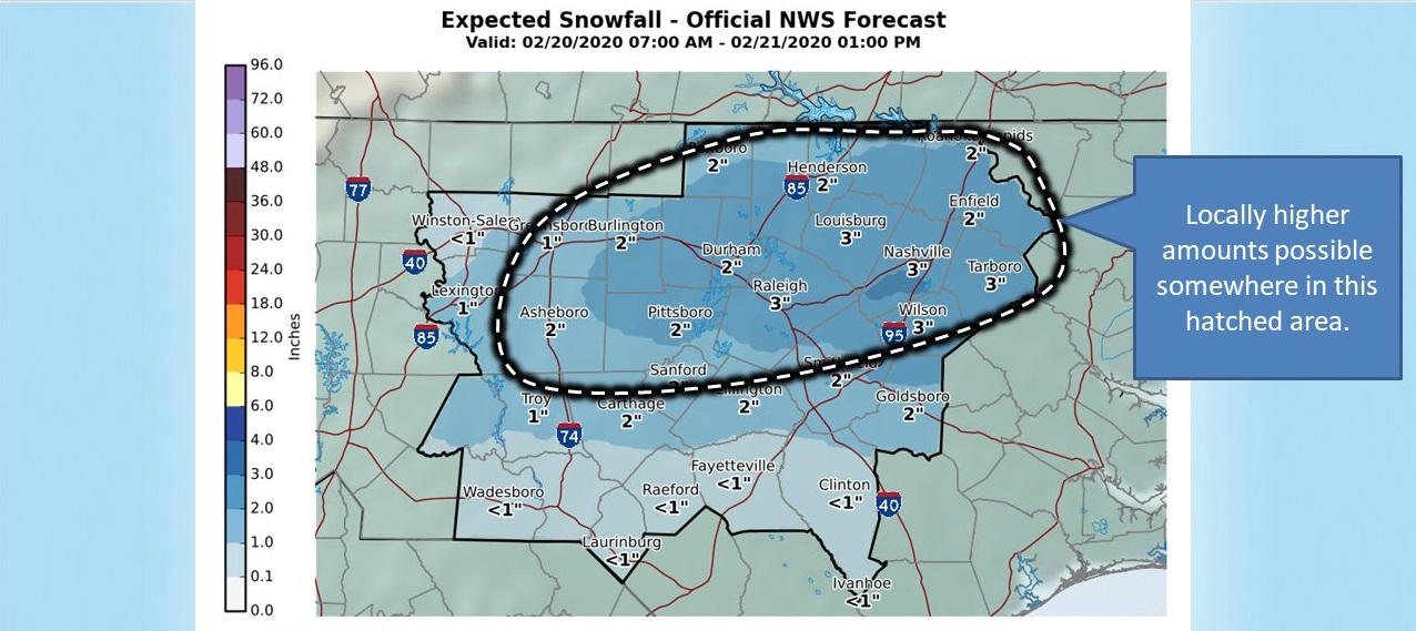
Winter Weather Advisory Issued for Orange County, Parts of ChathamThe National Winter Weather Service has issued a winter weather advisory for Orange County and Chatham County, as well as other counties in the region, for the upcoming days. Rainy weather is expected to turn to snow flurries over the course of Thursday, February 20, according to the department. By Thursday night, snow fall and […]
![]()
Orange County Under Winter Storm WarningNWS officials upgraded Orange County from a Winter Weather Advisory to a Winter Storm Warning on Friday afternoon. The warning is in effect until 4 p.m. Saturday.**** A Winter Weather Advisory is in effect for Orange County from nine o’clock Friday morning until four o’clock Saturday afternoon. The advisory from the National Weather Service […]
![]()
Winter Storm Warning Issued for Orange CountyThe National Weather Service has issued a winter storm warning for Orange and neighboring counties in response to projected snowfall across central North Carolina. The warning will remain in effect from Friday evening to Saturday evening, with three to five inches of snow accumulation possible in the Triangle area during that time. Kirby Saunders, the emergency management […]
![]()
NWS: Expect At Least 2-4 Inches Of Rain By SundayThe potential for high winds and post-storm flooding is just as worrisome as the rain itself.
![]()
Expect A Tenth Of An Inch Of Ice Tuesday NightThe National Weather Service has issued a Winter Weather Advisory from 7pm Tuesday through noon Wednesday.
![]()
Storm Tonight Will Drop Heavy Rain, Tornado PossibleThe National Weather Service is expecting an inch or more of rain to fall on the Triangle tonight.
![]()
Thin Glaze Of Ice Could Coat Trees Monday And TuesdayAnother dose of winter weather is on tap before spring officially arrives, but just how bad with this round be?
![]()
Cold Front To Bring Frozen PrecipitationNational Weather Service Senior Forecaster Scott Sharp says once the cold front moves through the Triangle between 7:00 and 7:30 Monday morning, we should expect rain to switch to sleet at about midday.
›
