RALEIGH – More winter weather is in store for the Triangle this week, with light snow on Monday night and Tuesday giving way to a nasty mix of snow and sleet on Wednesday.
National Weather Service meteorologist Darin Figursky says to expect light flurries tonight and some more light snow tomorrow. But the worrisome day, he says, will be Wednesday: “Late Tuesday night and through the day Wednesday, the system’s going to come our way, and people all over the Triangle are going to need to be prepared for a mixed bag of precipitation.”
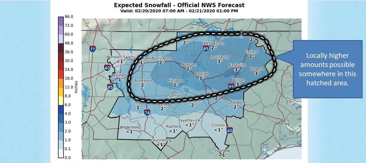
The National Weather Service has already issued a Winter Storm Watch for the Triangle, taking effect Wednesday at midnight and running until Thursday at 6:00 p.m. But Figursky says it’s still hard to tell exactly how much–and what kind of–precipitation will fall. “It depends on the timing of the system and where the system actually tracks,” he says, though the heaviest snow is likeliest just west of the Triangle.
“(There are) probabilities of almost anything” in Orange County on Wednesday, Figursky says, so “prepare for those icy roads…you might need to rearrange some plans as we get into that part of the week.”
The weather is projected to get better after Wednesday, but Figursky says there’s still some snow possible on Thursday–not to mention a chance of frozen precipitation lingering on the roads for several days thereafter.
“There could be some late-night and early-morning problems all the way into the early part of the weekend,” he says.


Comments on Chapelboro are moderated according to our Community Guidelines